About the Mascon Visualization Tool
Explorer Quick Launch:
GSFC |
JPL
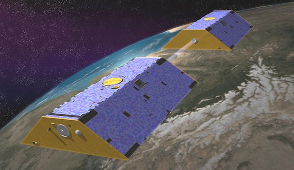
GRACE Mission
The Gravity Recovery and Climate Experiment (GRACE) and GRACE Follow-On are dual-satellite missions monitoring and mapping Earth's changing gravity field. GRACE produced monthly gravity field solutions from April 2002 through June 2017, and GRACE-FO has continued that record from June 2018. This time history has been an invaluable resource for tracking large-scale flooding, droughts, and glacial melting. Centers at JPL, NASA GSFC, CSR (UT Austin), and Germany's GFZ direct the release of periodic time-variable gravity solutions.
A variety of GRACE solutions are available to the community for study and use. Two such solutions are formed as mass concentration (mascon) estimates and developed by JPL and GSFC. This visualization tool uses these mascons to recover localized data from GRACE. Both sets of mascons provide a depiction of the temporal and spatial variations of Earth's gravity field. It is important to note that both of these mascon solutions are determined directly from the GRACE Level-1B data, as opposed to several proposed post-processing strategies that seek to estimate “mascons” from the Level-2 spherical harmonic solutions (e.g. Jacob et al., 2012).
JPL Mascons
Represented by 4551 equal-area, 3 arc-degree mascon cells located across the surface of the earth, this solution captures variations in the gravity field at each localized cell. Changes in any given mascon, therefore, represent the total changes to mass over the area of the cell. In other words, each cell represents the resolution of the GRACE data, and localized signals in areas smaller than that mascon cell are averaged over the whole mascon. Glacial Isostatic Adjustment has been corrected for by JPL using the ICE-6G_D model from Peltier et al. (2018).
For the data presented on this site, a number of additional steps have been taken to make the data as useful as possible to the user. Over oceans, the monthly mean atmospheric pressure has been restored so that ocean mascons reflect ocean mass, rather than ocean bottom pressure (the default for the JPL mascon solution). Basin and region mass estimates have been calculated according to Wiese et al. (2016) using GLDAS-derived scaling factors to divide mascons between basins. Over glaciated mascons and mascons without GLDAS information (e.g. the Great Lakes), basin and region boundaries were not allowed to bisect mascons, with the lone exception in Mascon 33, which is divided between Greenland and Ellesmere Island.
Coastline Filter
JPL uses a Coastline Resolution Improvement (CRI) filter to separate land signals from ocean signals in those mascons that are along the coast as a form of post-processing. As a result, land areas and ocean areas within the same mascon will return different signals when this filter is applied. This tool enables this filter; users that wish to use the unfiltered solution are encouraged to use the mascon data directly from JPL.
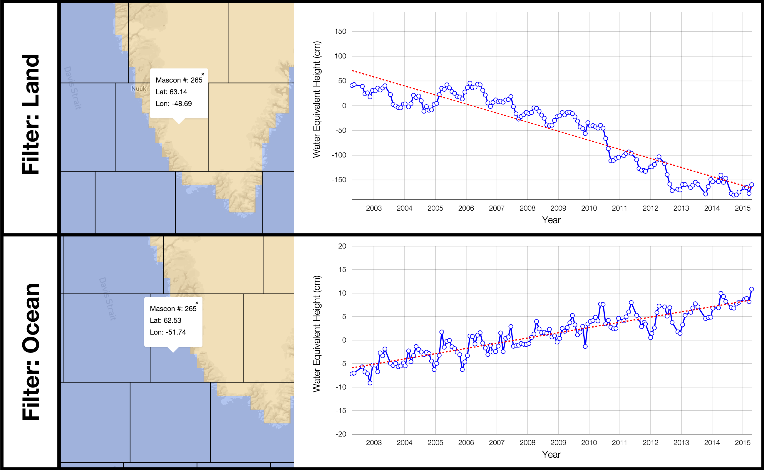
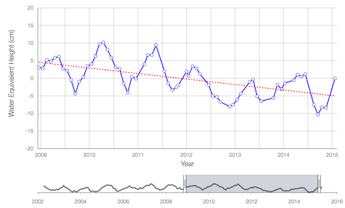
As a result of the coastline filter, land areas will return a different signal from ocean areas within the same mascon, as shown:
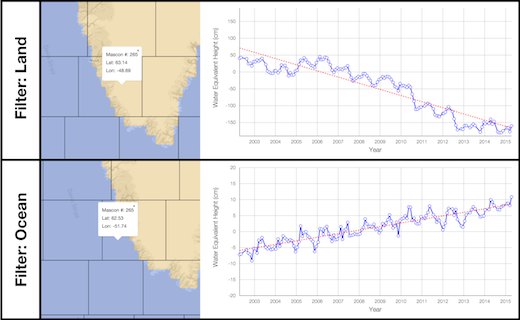
Comparison of land and ocean signals with CRI filter applied.
For more information regarding the JPL mascons, methodologies used in determining the JPL RL06M v02 Mascon solution, or information regarding the CRI filter, please visit JPL's Mascon page.
GSFC Mascons
This mascon solution is comprised of 41,168 equal-area, 1 arc-degree mascon cells. These mascons are solved for using spatial constraints that tie nearby mascons to each other. Six separate constraint regions are defined where mascons in different regions are uncorrelated, significantly reducing signal leakage across region boundaries. The constraint regions are: Greenland Ice Sheet above 2000 m, Greenland Ice Sheet below 2000 m, Antarctic Ice Sheet, Gulf of Alaska, land, and ocean.
It is important to note that these mascons are defined to 1 arc-degree in order to accurately define the constraint regions, but the fundamental spatial resolution of the solutions within a particular region is essentially the same as other GRACE solutions (~300 km). In other words, the time series of mass change for a particular mascon is highly correlated to the nearest mascons within the same constraint region.
This tool displays the standard global mascon product over land areas, and the Sea Level Anomaly product over oceans. For both, the ICE-6G_D Glacial Isostatic Adjustment model developed by Peltier et al. (2018) has been removed. These decisions make the JPL and GSFC mascons, as shown on this site, consistent with one another. Details about this solution's constraint techniques and data versions can be found at GSFC's Mascon page.
Using the Tool
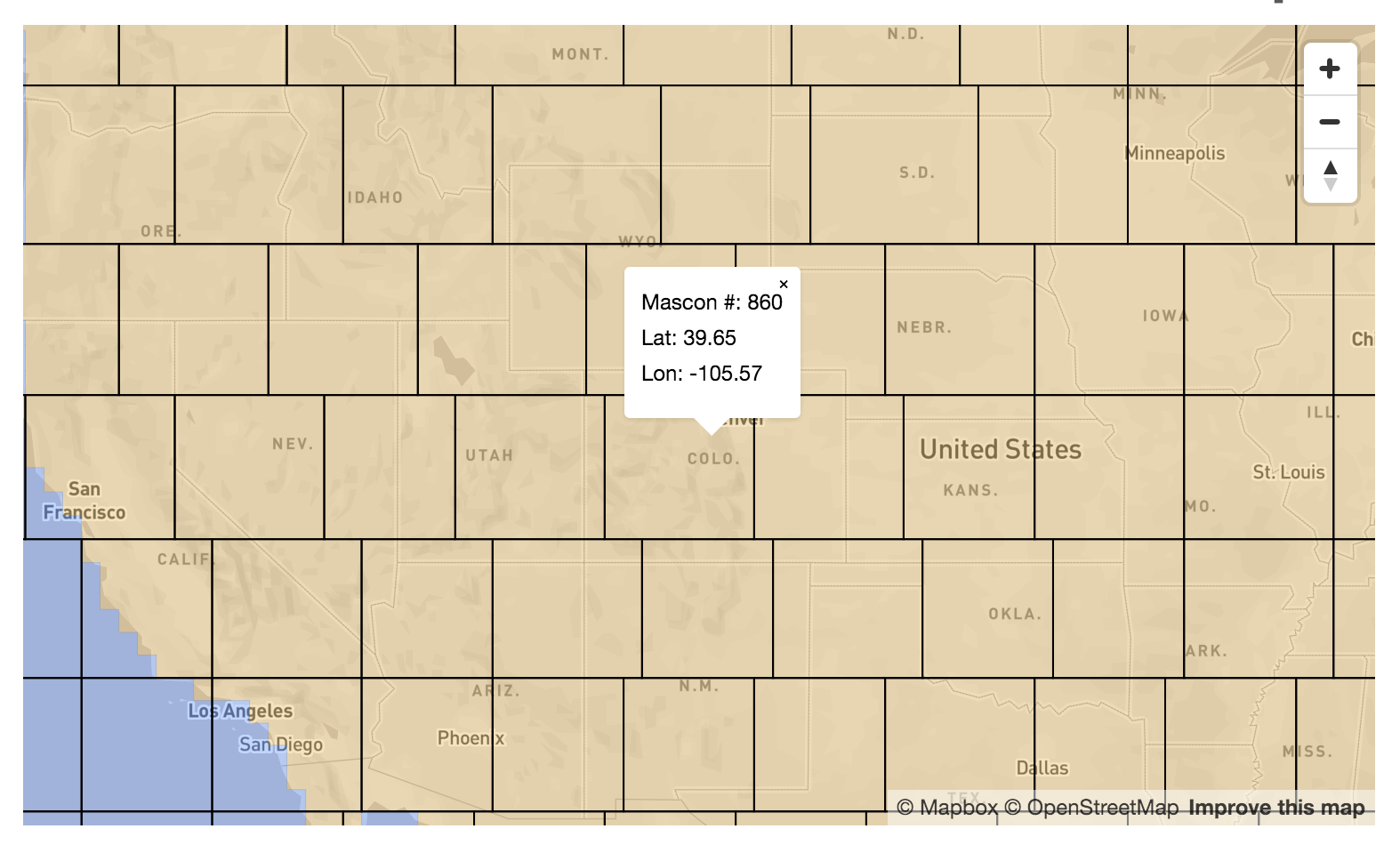
To use the Mascon Visualization Tool, simply select a location by clicking on the map on the main page or by inputing latitude and longitude coordinates into the map search form. When you select a location on the map, the map will zoom to an appropriate level and show the outline of the mascons, as shown in the image below.
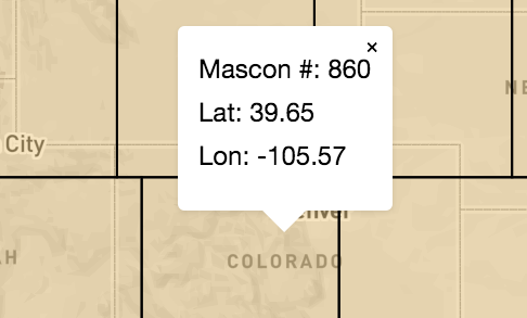
Selecting a mascon.
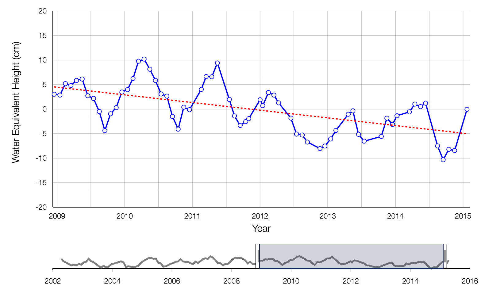
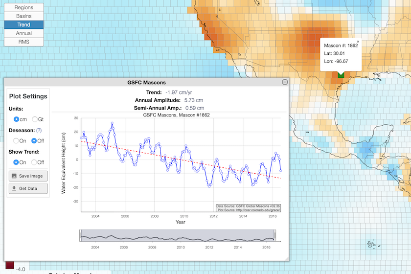
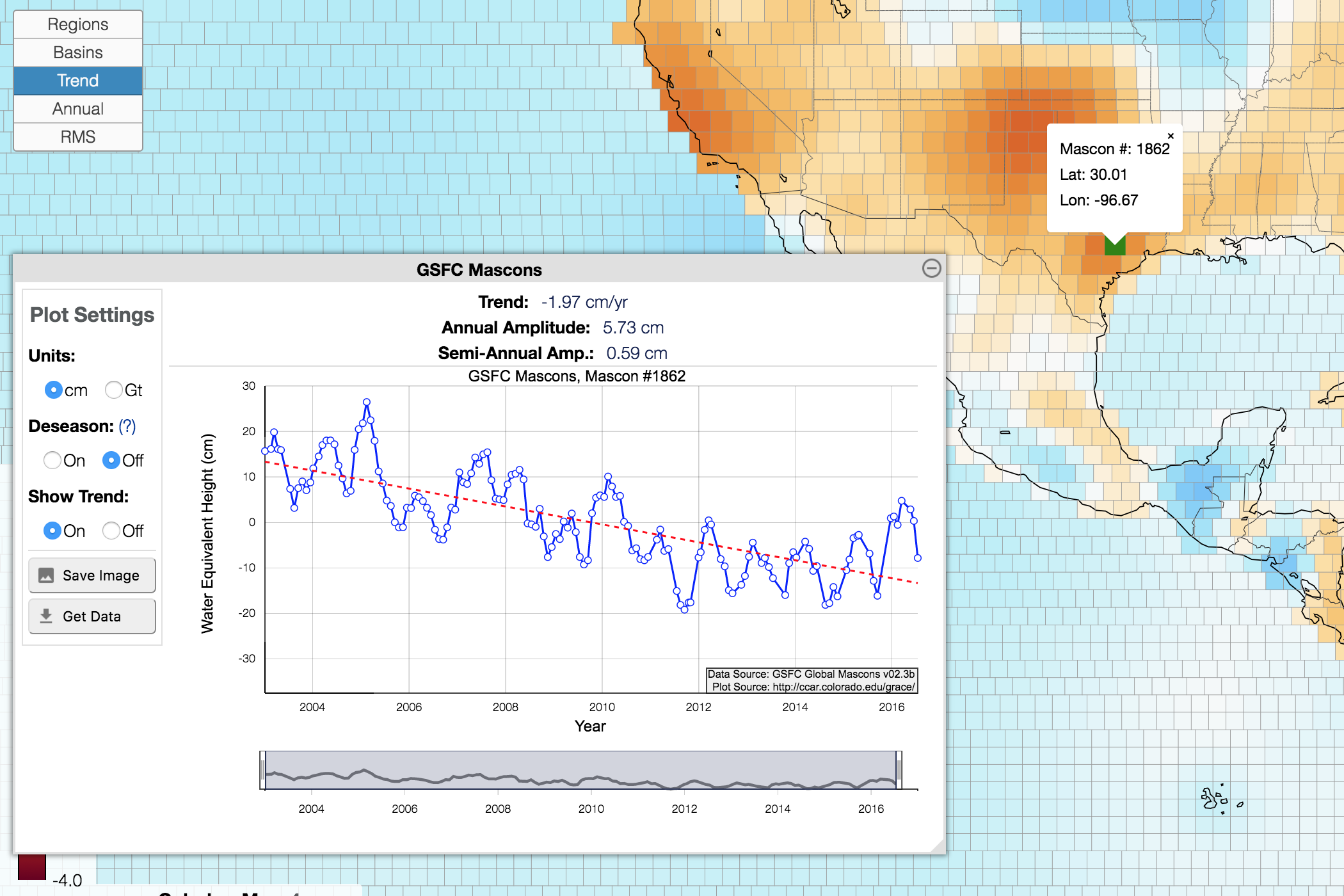
After selecting a mascon on the map, the tool will retrieve a timeseries for that mascon and plot it below. A slider at the bottom of the plot lets you select the timeframe over which data is plotted, as shown in the image below. Radio buttons at the right allow you to enable or disable plotting the best fit trend overtop the data, and also allow you to de-season the data. De-seasoning removes both the annual and semi-annual signals from the timeseries. Best fit parameters are estimated for the selected time interval; changing the interval will change the fitted parameters.
Examining the mascon's timeseries.
Regions
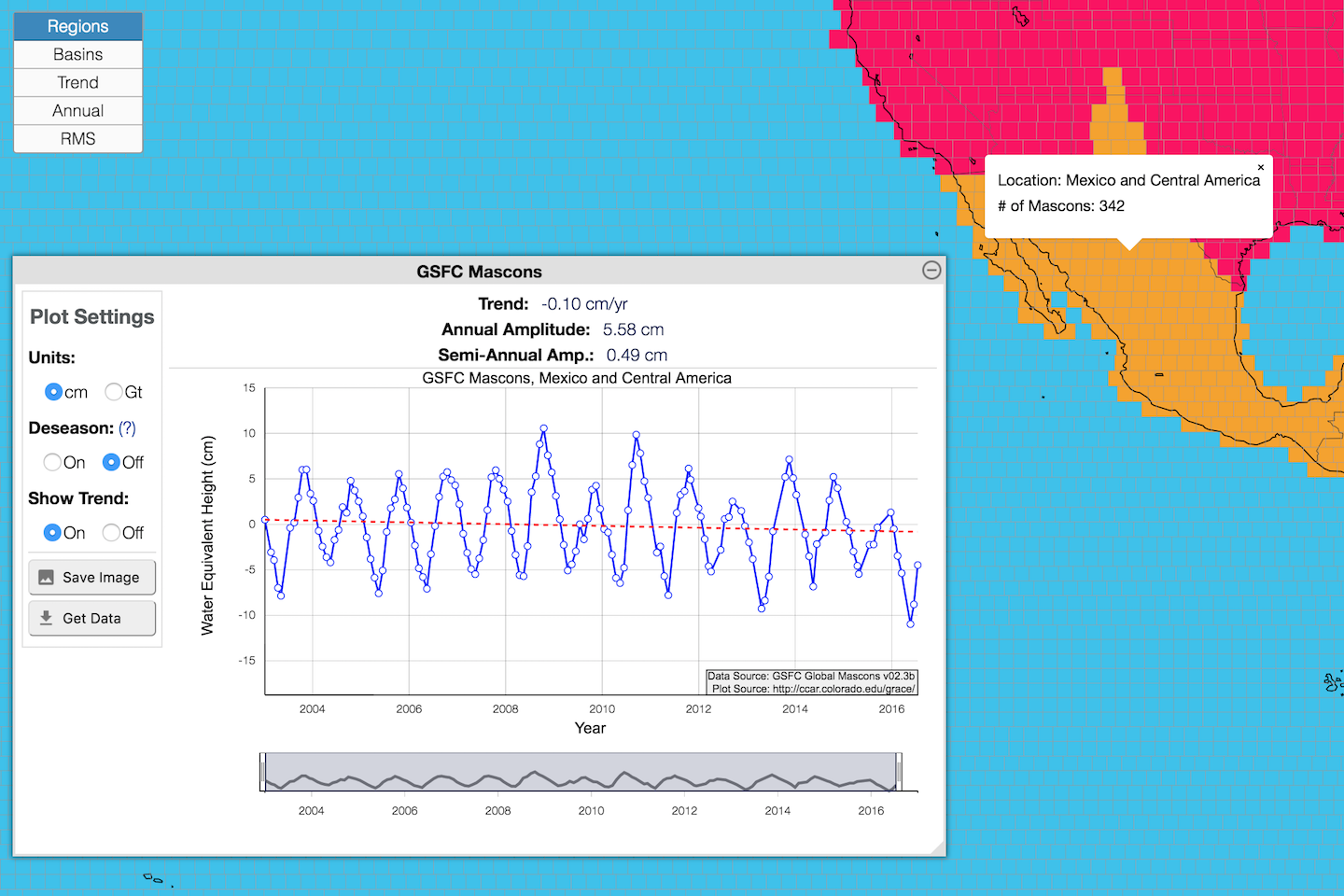
For the GSFC solution, users can view timeseries for more than just individual mascons. Similar functionality for the JPL solution is in development and coming soon. By default, the tool initially displays continental regions and large seas. Clicking on any of these regions will bring up a timeseries for that entire region along with information about that region, as seen in the image below.

Selecting a Region.
Basins
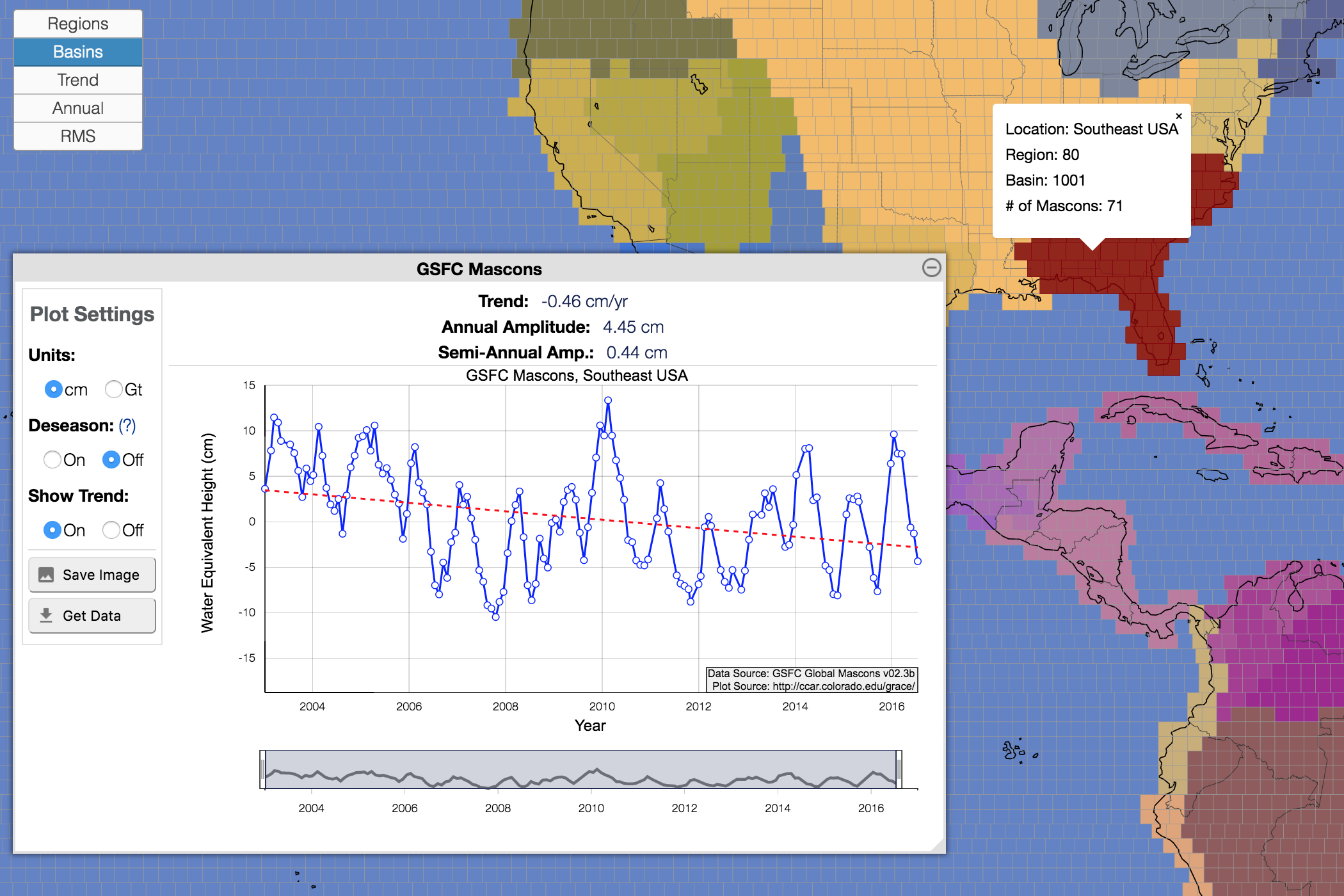
Choosing the "Basins" toggle breaks down the continental regions to distinct drainage basins. Selecting any mascon within a given basin will bring up the timeseries for that basin as well as information about the basin. The image below shows an example, selecting the Gulf of Alaska basin.

Selecting a Basin.
Individual Mascons
If you are interested in the timeseries of an individual mascon, these can be viewed by first setting the map view to "Trend", "Annual", or "RMS", and then selecting the mascon you wish to view. The timeseries will plot below, just as with the Regions or Basins.
Selecting a Mascon.
Acknowledgements and References
JPL Mascons
Solution Verison: JPL RL06M v02 Mascons
GRACE/GRACE-FO Mascon data are available at https://grace.jpl.nasa.gov.
D. N. Wiese, D.-N. Yuan, C. Boening, F. W. Landerer, M. M. Watkins. 2019. JPL GRACE and GRACE-FO Mascon Ocean, Ice, and Hydrology Equivalent Water Height Coastal Resolution Improvement (CRI) Filtered Releast 06 Version 02. Ver. 02. PO.DAAC, CA, USA. Dataset accessed 2020-08-03 at https://doi.org/10.5067/TEMSC-3JC62.
Watkins, M. M., D. N. Wiese, D.-N. Yuan, C. Boening, and F. W. Landerer (2015), Improved methods for observing Earth’s time variable mass distribution with GRACE using spherical cap mascons, J. Geophys. Res. Solid Earth, 120, doi:10.1002/2014JB011547.
Wiese, D. N., F. W. Landerer, and M. M. Watkins (2016), Quantifying and reducing leakage errors in the JPL RL05M GRACE mascon solution, Water Resour. Res., 52, 7490–7502, doi:10.1002/2016WR019344.
Landerer, F. W., Flechtner, F. M., Save, H., Webb, F. H., Bandikova, T., Bertiger, W. I., et al. (2020). Extending the global mass change data record: GRACE Follow-On instrument science data performance. Geophysical Research Letters, 47, e2020GL088306. https://doi.org/10.1029/2020GL088306.
GSFC Mascons
Solution Version: GSFC v02.4 Global Mascons
Luthcke, S.B., T.J. Sabaka, B.D. Loomis, et al., 2013, Antarctica, Greenland and Gulf of Alaska land ice evolution from an iterated GRACE global mascon solution, J. Glac. 59(216), 613-631, doi:10.3189/2013JoG12J147.
Data used by this tool is available at https://earth.gsfc.nasa.gov/geo/data/grace-mascons.
Additional References
Peltier, R. W., Argus, D. F., & Drummond, R. (2018). Comment on "An assessment of the ICE-6G_C (VM5a) glacial isostatic adjustment model" by Purcell et al. Journal of Geophysical Research: Solid Earth, 123, 2019-2028. https://doi.org/10.1002/2016JB013844
GSFC Mascon Homepage
JPL Mascon Homepage
GRACE Mission Homepage
Sign Up For Our Newsletter
We are continuously adding additional features to this site. If you would like to receive notifications when updates occur, join our mailing list.